


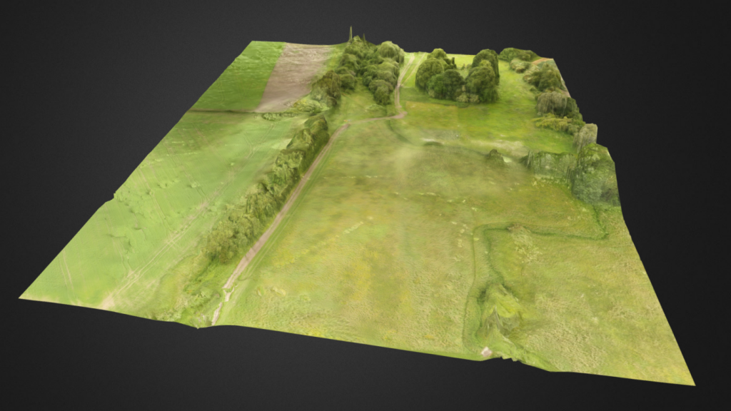
Commendium are currently partnering with Wardell Armstrong in providing detailed archaeological recording using drones for certain archaeological sites along the route of the proposed HS2 High-Speed railway. We have developed a process that allows us to capture not only video and photography for each of the sites but also elevation maps, orthomosaic maps, and 3D photogrammetric models. The data we are collecting is invaluable in determining if further investigation is needed in the areas but also allow for archaeologists to find new and hidden features.
On a recent survey, we were asked to assist the BBC in filming for a new documentary using our drone. This was because the permissions to fly over the sites is so tightly restricted that we were the only company with authority to perform this.
As these are active working sites, Commendiums surveyors have successfully applied for CSCS cards and qualifications to become authorised for construction site work. This has opened up a new avenue of work for Commendium and we are currently testing how to use photogrammetry within the construction industry. Our photogrammetric and LiDAR services are able to quantify the mass of excavations, provide detailed location data for constructions and accurately measure buildings, rivers, ditches and more. Aligned to the drone technology, we are able to carry out this work much quicker than traditional methods and much more accurately.
More archaeological recording using drones surveying for the HS2 project is coming in and we expect our involvement to continue over the next few years. The project does present some challenges for us, but our team of specialist are able to overcome this by providing a completely bespoke service. In this project, the flight plans are generally pre-determined, but room is left for changes when on site. An example of this is a recent site that had a number of red kites within the boundaries of the surveying area. An ecologist was on hand to check the nests and to advise our drone operator of any potential issues. In fact, during one of our flights, we can see one of the red kites fly within about 20 feet, but the bird of prey completely disregards our drone.
Have a look at what more we can do: Aerial Surveying, LiDAR sruveying